
Brazoria County Street Directory Path
Address work in Brazoria County has two different questions. The appraisal roll and deed index can establish a parcel and its ownership trail. They do not prove every person who stays at that address. Use a clean address first, then keep the legal description and geographic ID beside the street form. The street directory route below moves from a current parcel to older land records and only then to limited household evidence. That order matters when a road has a rural label, a plat name, or an older town reference.
- Search the address in Brazoria Central Appraisal District eSearch with the street number and street name. Save the owner, situs, mailing address, geographic ID, and legal description.
- Open the BCAD or county map, identify the parcel, and follow parcel polygons along both sides of the road. Record neighboring geographic IDs rather than relying on map proximity alone.
- Use the County Clerk public-record index to search the current owner as a grantee, open the purchase deed, and match its legal description to the parcel.
- Search the seller from that deed as an earlier grantee. Repeat the deed chain backward, including spouse, trustee, estate, business, and spelling variants when the document suggests them.
- For past household context, pair a city-directory street section with the matching census period. The individual voter tool does not provide a street-browse result.
Ownership, mailing address, and actual property location can differ. A homestead exemption may support an owner-occupancy clue, but it does not identify every member of a household or confirm day-to-day presence.
Brazoria County Street Search Fields
The Brazoria Central Appraisal District eSearch offers address, owner, ID, and advanced paths. For an address search, enter the number separately and omit prefix, suffix, and unit information from the Street Name field. A simple street-name search can be more useful than an exact address when looking along a road. The available fields also make it possible to reconcile an urban lot with a subdivision, or a rural tract with an abstract or geographic ID.
The BCAD property-search screen shows the fields used for a Brazoria County street directory search.
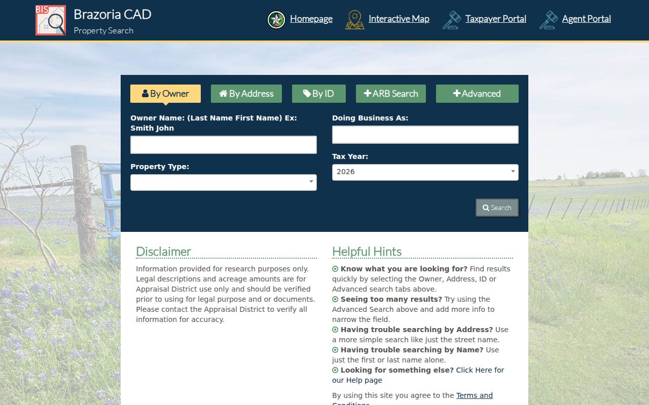
Use the address tabs for the starting point, then retain the geographic and legal identifiers shown in the result.
| BCAD field | Type | Required | Use in an address search |
|---|---|---|---|
| Owner Name | Text | No | Last name first; a first or last name alone may help. |
| Street Number | Text or number | No | Combine with Street Name. |
| Street Name | Text/autocomplete | No | Do not enter a prefix, suffix, or unit number. |
| Abstract | Autocomplete/list | No | Useful for a survey or abstract search. |
| MobileHomePark | Autocomplete/list | No | Searches mobile home parks. |
| Property ID | Text or number | No | Account or property identifier. |
| Property Type | Dropdown | No | The portal does not expose an exhaustive text list of options. |
| Agent ID | Text | No | Advanced appraisal-agent field. |
| Protest Status | Text/dropdown | No | Advanced status field. |
| Informal Date | Date | No | Advanced field. |
| Doing Business As | Text | No | Business or personal-property association. |
| Subdivision | Autocomplete/list | No | Connects a platted address with its subdivision. |
| Condo | Autocomplete/list | No | Searches condominium records. |
| Owner ID | Text or number | No | Owner identifier shown by the portal. |
| Geographic ID | Text or number | No | Parcel geographic identifier for map and deed matching. |
| Tax Year | Dropdown | No | Current options vary in the live portal. |
| Neighborhood | Autocomplete/list | No | Searches the district neighborhood field. |
| Hearing Date | Date | No | Advanced field. |
| Board Members | Text | No | Advanced protest field. |
| Formal Date | Date | No | Advanced field. |
| Search | Button | Not applicable | Primary control; Owner, Address, ID, and Advanced tabs are visible. |
Property Type, Agent ID, protest-status and hearing-date controls appear under advanced search. They are appraisal tools, not household fields. The portal also notes that legal descriptions and acreage need independent verification.
Brazoria County Street Tax Clues
The county tax search separates an owner’s mailing address from the actual property location. That distinction can resolve a common street-directory error: a mailing address might point somewhere else even while the tax account identifies the local parcel. Its Property Location hint says to omit street type and direction. Account Number, Owner Name, account status, and paid or unpaid filters provide alternate ways to find the same tax account when the formatted street form fails.
The Brazoria County tax search illustrates the mailing-address and property-location choices.
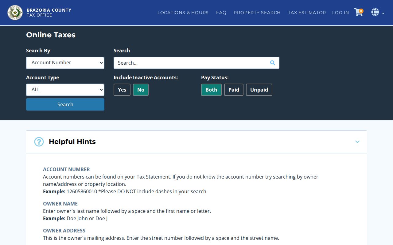
Compare the tax account’s property location with the BCAD situs before treating either address as the same thing as an occupant record.
Brazoria County Address Record Coverage
Several Brazoria County sources are keyed to an address or parcel, but they answer different questions. The appraisal card is the current starting point. The County Clerk index supplies the ownership sequence. Maps provide location context, while city files may provide a dated project or complaint category where that city maintains a report. The table keeps the distinctions visible before a street-directory search turns a property clue into an unsupported claim about people.
| Address record | Keeper | What it shows | Access |
|---|---|---|---|
| BCAD search/card | Brazoria Central Appraisal District | Owner, mailing and situs address, parcel, legal description, values and exemptions | Public eSearch and map |
| Tax account | Tax Assessor-Collector | Owner mailing address, actual property location, account and pay status | Public search page |
| GIS parcel | BCAD and County Engineering | Parcel geometry, roads, flood, drainage, city and precinct context | Map or GIS data request |
| Deed or plat | Brazoria County Clerk | Title transfer, legal description, lot/block, liens and easements | Online index, counter, copies |
| Permit or code record | Relevant city office | Address, date, project, contractor, fee or valuation where maintained | City report or public-information request |
| Voter record | County Registrar or Texas SOS | Registered record, address and precinct only as lawfully available | Individual lookup or permitted file request |
| Historical directory | Library or archive | Older address-to-household snapshot when a local run exists | Catalog, scan, or microfilm |
Parcel and geographic IDs join the property card to the map. The legal description joins the property card to an older deed. A street name by itself is the weakest bridge, especially outside platted areas.
Brazoria County Street Parcel Maps
BCAD’s interactive map and county GIS are useful for walking a road visually. Locate the address, click the target polygon, read its identifier, and click the parcels touching it or directly across the road. Re-open each result in BCAD using the geographic ID or legal description. County layers add roads, City Limits with ETJ, floodplain, drainage districts, precincts, bridges, service centers, and thoroughfares.
Those layers answer geographic questions, not ownership proof. County GIS routes parcel ownership and assessment questions to BCAD, and its map is not a daily update or an official survey. Engineering or floodplain staff are the better channel for a boundary, road, or flood question requiring official confirmation.
Brazoria County Street Deed Chain
The Brazoria County Clerk public-records search carries the title trail behind a street address. Search the BCAD owner as a grantee around the likely acquisition date, then inspect the purchase deed. The deed can show the grantor, grantee, execution and recording dates, instrument number or book/page, legal description, prior-deed reference, and recorded encumbrances. Search the seller as an earlier grantee and match the legal description again.
The county-linked index listing showed Full Index coverage from 05/09/1829 through 08/14/2026 when captured. Treat the ending date as a live portal value that must be checked at the time of use. The Clerk warns that online material can be redacted and is not necessarily the complete or unaltered official repository. East Annex public computers at 1524 E. Mulberry in Angleton offer a fallback, and the counter or a copy request is appropriate when an online image is unavailable.
Brazoria County Street Record Terms
Address forms change, but the identifiers below make a Brazoria County street directory search more durable. They are especially important on rural roads, where the record may be organized around a survey, abstract, or acreage rather than a conventional number.
- Parcel
- A defined piece of land in the appraisal and map systems, often associated with a property or geographic ID.
- Situs address
- The actual property location used for the parcel, distinct from an owner’s mailing address.
- Plat
- A recorded map that ties a subdivision lot and block to its legal description.
- Criss-cross directory
- A historical directory arranged by address so a researcher can look for the entry associated with a location.
For an unplatted tract, use the abstract or survey, road, acreage, and map location. A recorded mineral lease or pipeline easement may name an owner or entity connected with land, but it is not an occupancy record.
Brazoria County Street Voter Limits
Texas My Voter Portal is an individual confirmation tool, not a street browser. A name search may use first name, last name, date of birth, ZIP, and county, while a VUID or qualifying Texas driver-license number supports other methods. A permitted voter file can be requested by county, precinct, election, and other selections, but it carries form, payment, affidavit, and use conditions. Texas does not register voters by permanent political party, and a public record does not reveal ballot choices.
Texas Election Code §18.005 governs the content of official voter lists, subject to confidential-address protections. A protected address may be omitted or shown with asterisks. The individual tool cannot establish everyone who lives along a road, and a voter list cannot establish children, non-voters, or other household members.
Note: The voter record is a limited registration source, not a census of a Brazoria County street.
Brazoria County Street Directory History
Historical city and telephone directories can supply an older address snapshot, often with a householder, spouse, telephone, occupation, or address notation. Local coverage is town-specific and has not been verified as a single countywide run. Ask the Brazoria County Library System genealogy staff or the Historical Museum for catalog and research-file leads, then pair a directory year with an available census schedule through 1950. That pairing helps distinguish a property owner from an older household entry.
The Texas State Library and Archives Commission’s Brazoria microfilm inventory documents the offline bridge for older land and court-era records.
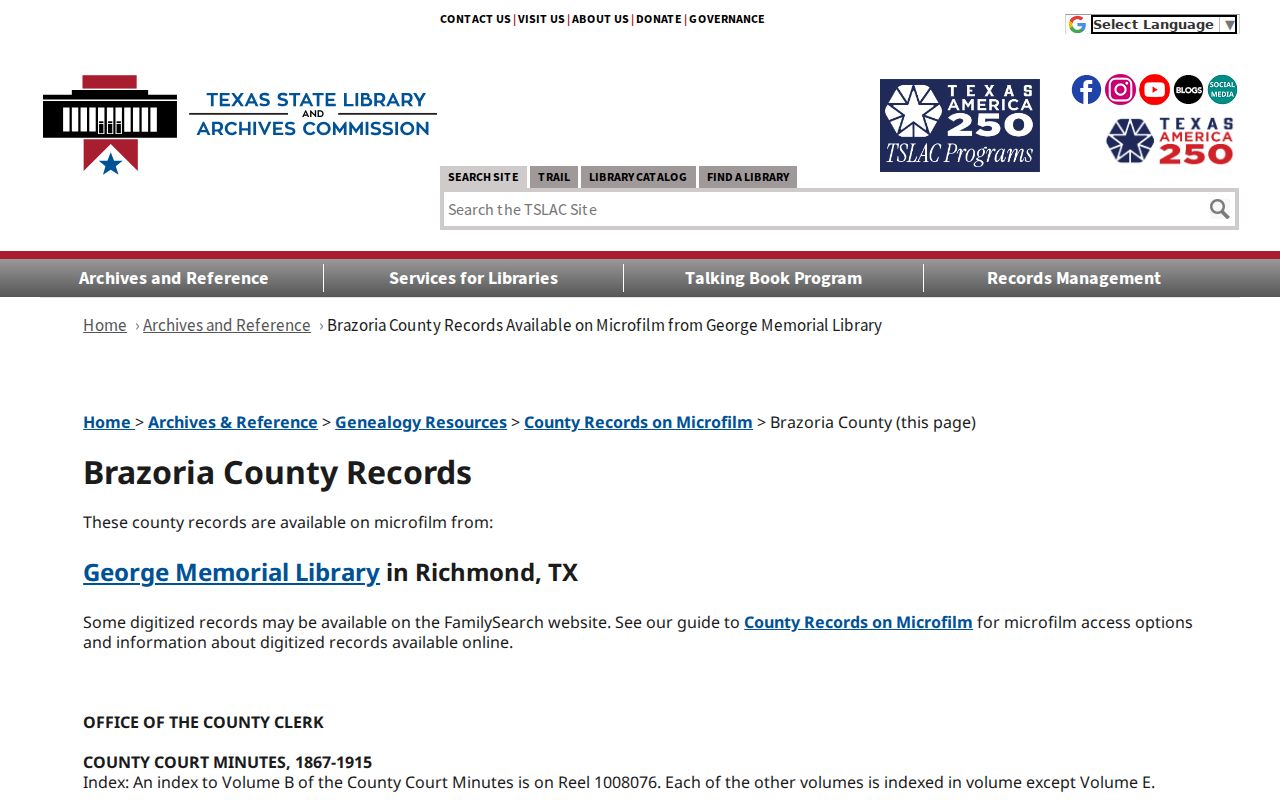
The listed reels include deeds, Spanish deeds, tax rolls, probate material, marriage records, and county minutes that can help when an address is absent from a web result.
Brazoria County Street Geography
Modern city-limit and ETJ maps are the verified starting point for deciding which city or county office may hold a street record. Older deeds can instead name Brazoria, Velasco, Columbia, West Columbia, or a rural post office. Brazoria was the county seat until Angleton replaced it in 1896, so older courthouse and town labels can be meaningful rather than contradictory.
No confirmed Brazoria County street-renumbering or street-renaming year was located. Do not assign one to a failed exact-address search. Bridge the record with a plat, lot and block, abstract or survey, old road name, post-office label, and legal description, then ask the relevant city engineering office or archives about local addressing history.
Brazoria County Street Directory Limits
A street directory can identify publicly recorded land and limited historical or registration evidence. It cannot produce a complete list of all people at an address. Appraisal records normally omit non-owner household members. Utility customers, delivery information, motor-vehicle addresses, protected voters, sealed cases, and confidential records remain unavailable. Online appraisal notices also restrict posting residential photographs, sketches, floor plans, and age-related information.
Lawful use. Use Brazoria County address records for personal, family-history, civic, property, or safety research. Texas Penal Code §§42.07 and 42.072 prohibit harassment and stalking; records do not authorize following, threatening, repeated contact, or surveillance.