
Brazoria County Neighbors by Block
A block-level search starts with the target parcel and expands only to parcels that share a boundary or sit directly across the road. Public sources reveal different kinds of context. The county’s GIS layers describe geography. BCAD supplies parcel and owner fields. The Clerk supplies ownership chronology. Voter sources have limits, and association records point to public management contacts rather than a neighborhood roster. Use each result for the narrow question it can actually answer.
| Source | What it shows about a block | Access |
|---|---|---|
| GIS parcel map | Parcel boundaries, adjacent parcels, roads, flood, drainage, and precinct context | Free map with visual-reference warning |
| BCAD cards | Owner, mailing and situs fields, legal description, parcel, exemption and value fields | Public eSearch, not a household roster |
| County Clerk deeds and plats | Ownership chronology, subdivision, lot and block | Index, copy, or counter |
| Voter record or file | Registered record, address, precinct, and history as lawfully available | Individual lookup or permitted request |
| City permit or code record | Address-specific project or complaint information where maintained | City report or public-information request |
| HOA certificate | Association, management contact, city, ZIP, and certificate details | Texas AG search and PDF, not member data |
| Civic directory | Public organization contact information | EDA directory |
Parcel ownership and household presence are not the same fact. A mailing address, a homestead indicator, and an adjacent polygon can supply useful property context without establishing who is present at a home.
Brazoria County Neighbor Parcel Method
Open the target in the BCAD map or county GIS, click the polygon, and write down its geographic ID, street form, and legal description. Then click every parcel sharing a boundary and any parcel directly across the road or along the immediate road segment. Open each corresponding BCAD card and compare its owner, mailing address, situs, homestead indicator, subdivision, lot and block, and map position. On a rural road, the practical block may be a road segment identified by survey, abstract, or legal description.
- Find the target parcel and save its geographic ID and legal description.
- Click adjoining and directly opposite polygons, not a broad radius of unrelated lots.
- Open every selected BCAD card and compare parcel fields with the map.
- Use the Clerk deed index if ownership timing or a subdivision plat needs confirmation.
- Use the Brazoria County street directory for the larger street-by-street property trail.
Map proximity does not establish kinship, friendship, shared household status, or a reason to contact anyone. It is simply a method for locating adjacent land records.
Brazoria County Neighbors Property Cards
The Brazoria Central Appraisal District eSearch can be searched by owner, street number, street name, property ID, subdivision, owner ID, geographic ID, tax year, neighborhood, and other advanced fields. Street Name excludes prefix, suffix, and unit numbers. Search the simpler road name when an exact address fails, then use the result’s legal and geographic fields to return to the appropriate parcel.
The BCAD property search provides the parcel fields used when comparing nearby Brazoria County neighbors.
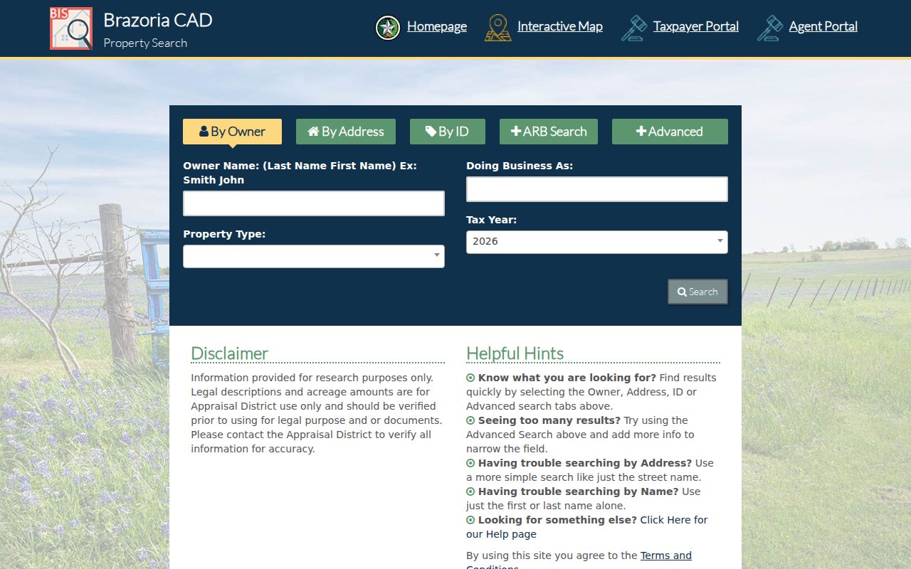
The card can distinguish a property location from an owner mailing address, but it cannot supply a complete account of nearby people.
Brazoria County Neighbor Tax Fields
The Tax Assessor-Collector search reinforces the address distinction. Its Owner Address option refers to a mailing address, while Property Location refers to the actual property address and asks users to omit street type and direction. Account Number, owner name, active or inactive status, and paid or unpaid filters are alternate paths. Compare the property location to BCAD situs details before treating an account address as a clue about a person.
The Brazoria County tax search shows the owner-address and property-location controls.
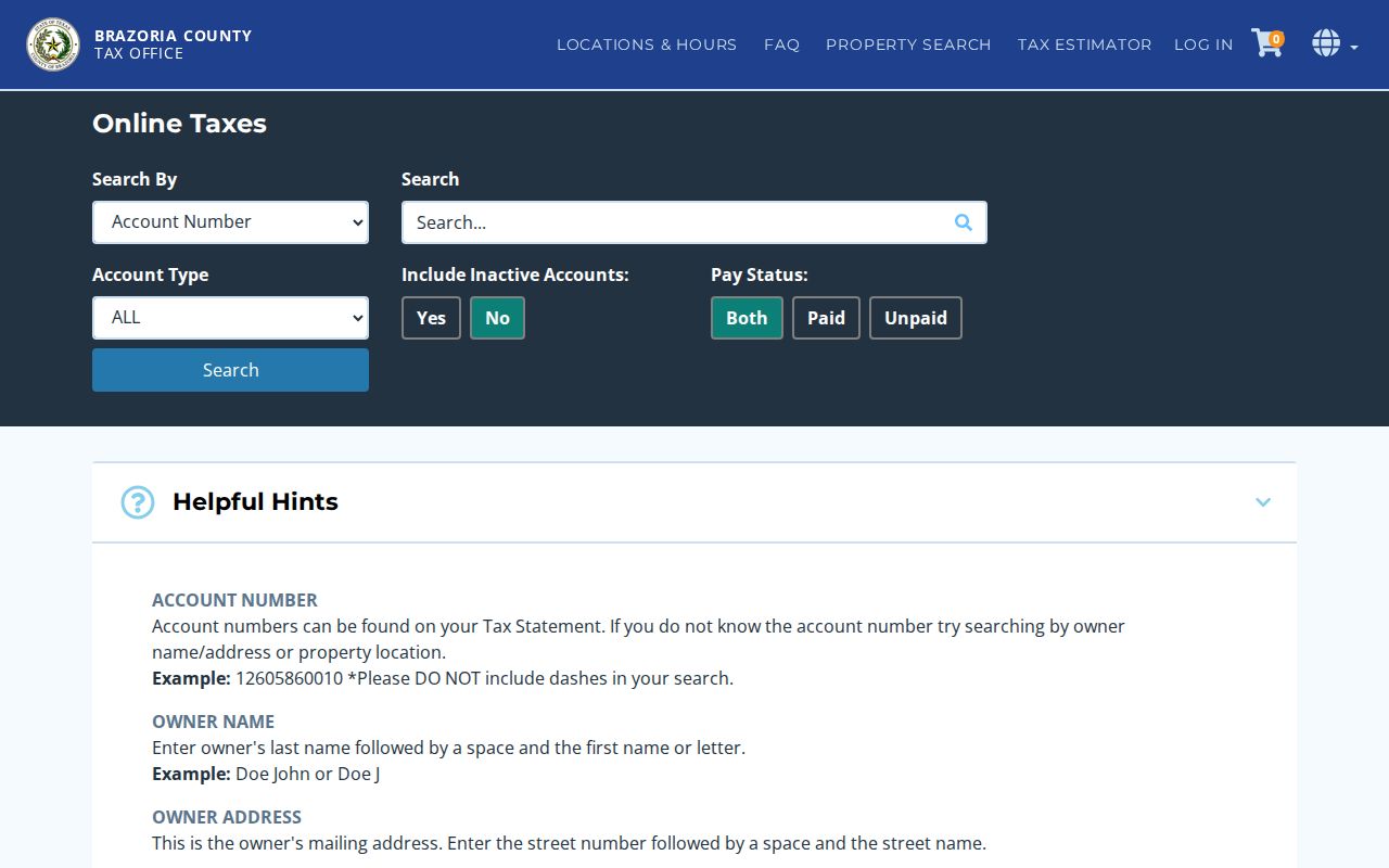
Tax account data adds parcel context and payment status, not a public block roster.
Brazoria County Neighbor Map Layers
County Engineering maps add City Limits with ETJ, roads, floodplain, drainage districts, precincts, bridges, service centers, and thoroughfares to the parcel view. Use the layers to understand why adjacent properties may be governed by different geographic labels. The county directs ownership and appraisal questions to BCAD. Its map is a visual tool and does not promise daily updates or an official boundary survey.
For a more formal map-data question, County GIS accepts requests at engineer-GIS@brazoriacountytx.gov and asks for the requester’s contact details, organization status, desired format, and extent. BCAD mapping help is another lane for appraisal-map questions. Neither channel converts approximate map geometry into a boundary survey, so a survey, permit, or flood determination still needs the responsible office.
Brazoria County Neighbor Map Quirk
One map view can point to different custodians. BCAD supplies ownership and appraisal information, while County Engineering and floodplain channels handle roads, drainage, floodplain, and map context. That split is useful when a nearby parcel seems to touch a flood layer or an ETJ boundary: verify the land record with BCAD and direct the geographic question to the office responsible for that layer. It is a records-custody distinction, not a conflict in who belongs on a block.
Brazoria County Neighbor Voter Limits
No official public tool was located for browsing everyone on a street. Texas My Voter Portal confirms an individual record using its permitted methods. A voter file may be requested by county, precinct, election, and other options through local or statewide forms, subject to payment, affidavit, delivery, and statutory conditions. Texas Election Code §18.005 addresses official list content, but an online individual result is not the same as a requested list.
Protected voters can be omitted or displayed with asterisks. Texas Election Code §13.004 protects qualifying address information and other confidential fields. A voter record cannot establish every household member, and it does not disclose ballot choices. Treat a protected or absent address as a privacy rule, not a gap to work around.
Brazoria County Neighbor Association Contacts
The Texas Attorney General management-certificate search filters by HOA name, Brazoria County, city, ZIP, and association type. Its PDFs expose association and management contact details that were filed with the program. They do not expose a public member roster, and the site cautions that reliability depends on submitted information. Use the certificates to find an association contact, rules, or public meeting path, not to identify private members.
The filtered Brazoria County HOA certificate search is the source for these public community contact leads.
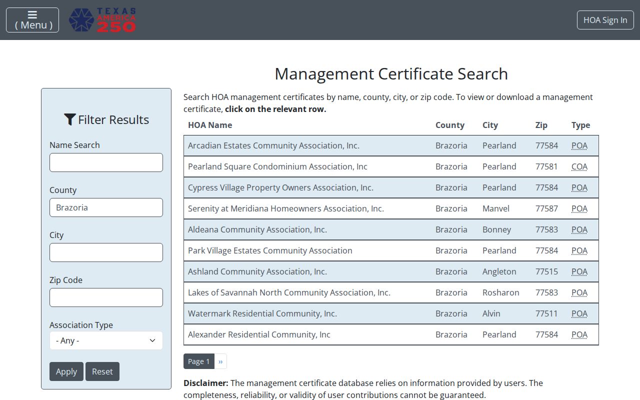
Each result is a contact and management record, rather than evidence that a given person belongs to the association.
| Association or community | Area and ZIP | Public contact path |
|---|---|---|
| Forest Heights Property Owners Association of Alvin | Alvin 77511 | AG management certificate; no public member list |
| San Luis Pass Resort Community Civic Association | Freeport 77541 | AG certificate with civic or POA contact |
| River Mist HOA and Pearland Square COA | Pearland 77581 | AG management-contact PDFs |
| Village of Biscayne Bay and Village of Diamond Bay | Pearland 77584 | AG POA contact path |
| Cold River Ranch | Rosharon 77583 | AG association contact path |
| Valencia Residential Owners Association | Manvel 77578 | AG association contact path |
| Bar X Ranch POA | Angleton 77515 | Official association site with public rules and committee contacts; member directory not public |
Brazoria County Neighbor Civic Contacts
The Brazoria County Economic Development Alliance civic directory lists public organization contacts such as the Alvin-Manvel Area Chamber, Angleton Chamber, Brazoria Chamber, Brazoria County Hispanic Chamber, and Brazosport Area Chamber. It is a directory for organizations, not a directory of people on a block. The County Constable community-relations route can also identify public meetings or civic programs without requiring a private list.
The EDA community and civic organization directory is the source for public-contact leads.
Organization addresses and phones can support a community inquiry while leaving private membership information with the organization.
Brazoria County Neighbor Source Comparison
Official records identify their custodian, scope, and correction path. They are stronger for parcel, deed, precinct, and association-contact facts. Commercial neighbor-lookup services are a category that can combine public, marketing, and parcel data. Such results can be stale, merge same-name records, omit protected information, and make their source trail hard to check. A category result is a lead to verify with an official custodian, not proof of a current household.
| Official record route | Commercial category |
|---|---|
| Identifies the responsible office and the record type | May combine records from different dates and sources |
| Allows a correction request through the custodian | May provide a separate suppression process, without changing source records |
| Has stated access and privacy limits | Can carry incomplete or incorrectly merged entries |
Brazoria County Neighbor Geography
Brazoria County includes suburban, coastal, city, ETJ, and rural address systems. An adjacent road segment may cross city limits, drainage districts, or a post-office boundary. Rural properties can be described by survey, abstract, acreage, or road rather than a platted block. A delivery city and ZIP do not prove a municipality, precinct, school district, or commissioner precinct. Use map layers and legal descriptions to keep the block definition honest.
Older records may use Brazoria, Velasco, Columbia, West Columbia, or a rural post office rather than a current municipal label. Brazoria was county seat until Angleton replaced it in 1896. That change in records geography can explain why a deed, court-era entry, or plat carries an older town name even when the same land is now reached through a different city label.
Note: The closest useful parcel may be across a road or along a rural segment, not simply the next number in an address sequence.
Brazoria County Neighbor Privacy Limits
Public parcel adjacency is a land-record tool, not a way to identify every person nearby. Non-owner household members, utilities, delivery information, motor-vehicle records, protected voter addresses, sealed proceedings, adoption information, and nonpublic association membership remain private. City code complainant identity can also be exempt from public release. No public community source should be used to pressure, track, or escalate contact with anyone.
Lawful use. Use Brazoria County neighbor records for property context, family history, civic research, public community contacts, or safety awareness. Texas Penal Code §§42.07 and 42.072 prohibit harassment and stalking; do not use records to follow, threaten, repeatedly contact, or surveil a person.